News Story
Have Drone, Will Travel: UMD Team Conducts Tests in O’ahu
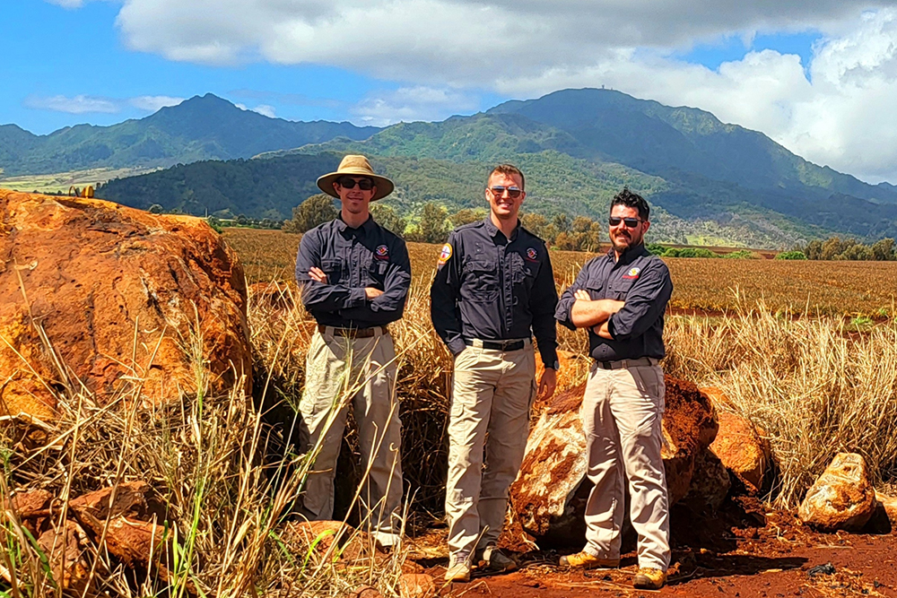
Acres of red dirt—the product of tropical weather that leaches away lighter minerals, leaving behind iron oxide—provided a striking backdrop to drone flights conducted by the University of Maryland (UMD) UAS Test Site on the Hawaiian island of O’ahu earlier this year.
Over three weeks, Project Engineer Josh Gaus, Chief UAS Pilot Darren Robey, and UAS Test Engineer Grant Williams conducted more than 300 flights, collecting calibration data for Medium Earth Orbit Local User Terminals (MEOLUTs) used in the international satellite-aided search and rescue effort, Cospas-Sarsat. These MEOLUTs receive distress signals from commercially available emergency beacons relayed through Cospas-Sarsat instruments in space. Search and Rescue operations centers share data from the MEOLUTs with first responders to aid in the rescue of people in distress around the world.
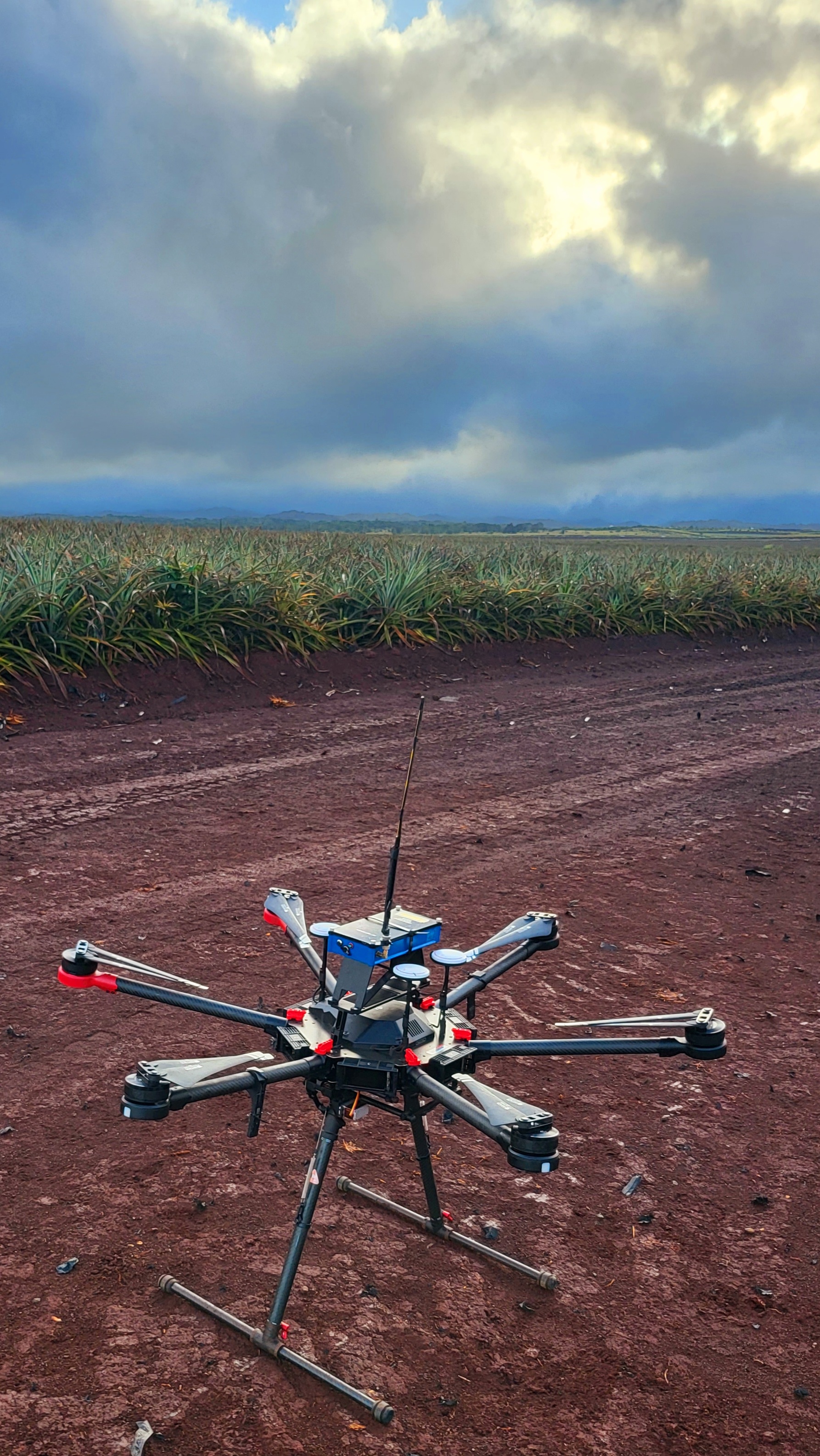
The Test Site team equipped a drone with a 406 MHz beacon and flew it in patterns requested by NASA and NOAA.
NASA’s Search and Rescue office and the National Oceanic and Atmospheric Administration (NOAA) have been helping to test the processing of slow-moving beacons through the Medium Earth Orbit Search and Rescue system (MEOSAR), which includes instruments on most U.S. GPS satellites. MEOSAR provides an alternative to existing low-Earth orbit and geostationary search and rescue systems, which have been in operation for decades. Additionally, MEOSAR can offer more accurate distress location services and quicker response times.
But validation and calibration are required in order to ensure this improved accuracy. Otherwise, search and rescue teams may have trouble pinpointing the source of a slow-moving beacon distress signal.
“That’s where we come in,” Robey said. “Drones can provide an efficient way of simulating slow-moving beacons, allowing the validation of the data received by the terminals.” In the past, he noted, agencies have relied on various other methods—including, in some cases, strapping a beacon to a concrete mixer and tracking the signal as it spins.
To validate the system with drones instead of construction equipment, the UMD UAS team equipped its aircraft with beacons broadcasting at 406 MHz—the frequency used by actual Cospas-Sarsat beacons—and flew the aircraft in pre-planned, controlled directions and speeds. Meanwhile, the Hawaii MEOLUT tracked the beacon’s path.
“By pulling our telemetry and sharing it with the NASA/NOAA group, they could assess overall accuracy and make any needed adjustments,” Robey said. “The more we flew, the more data they had to support the necessary calibrations/validations.”
The team kept to a rigorous schedule, collecting as much data as they could while in O’ahu. The first day’s flights began before 8 a.m. Flights were conducted for about six hours each day, with late afternoon hours devoted to completing logs and recharging equipment. With mild weather prevailing and rain holding off until their third week, the schedule remained largely unchanged from day to day.
“We’re confident that this represents the way forward for MEOLUT calibration, and we’ve built a robust operational framework for using drones in this capacity,” Robey said. “We look forward to future tests with our colleagues at NASA and NOAA.”
The Hawaii mission followed previous UMD UAS Test Site operations in Florida and Maryland, the location of the two other U.S. MEOLUTs.
Published June 20, 2022
Recent Stories
Stories / Jul 23, 2026
New Graduate Program Teaches Real-World Autonomy Skills

Stories / Jul 20, 2026
Building Bridges to Accelerate Innovation

Stories / Jul 10, 2026
MATRIX Helping Maryland Build Tomorrow's Workforce

Stories / Jul 1, 2026
Establish Research Partnerships at the MATRIX Open House

Stories / Jun 25, 2026
Grand Challenges 2.0: Engineers Partner to Unlock Solutions

Stories / Jun 25, 2026
Aircraft May Refuel Themselves - With Help From AI

Stories / Jun 24, 2026
Dean Graham Reappointed to Second Five-Year Term

Stories / May 28, 2026
Generations of Graduates: A Full-Circle Celebration

Stories / May 22, 2026
Costello: Advancing Aerial Autonomy

Stories / May 22, 2026
ECE PhD Student Sydney Overton Receives Ann G. Wylie...
